
The Catlins: A Three-Day Itinerary
The Catlins was, without a doubt, the best place we found on the South Island. There are very few other drivable places in New Zealand where you get scenery this stunning without the crowds. As you drive, you’re surrounded by pure nature, and sometimes the only other thing you’ll see for long stretches is another campervan going the other way.
The coastline reminded us of our home county, Cornwall, back in England. Those rugged cliff edges made us feel oddly at home, and we hadn’t seen a coastline quite like it anywhere else in New Zealand.
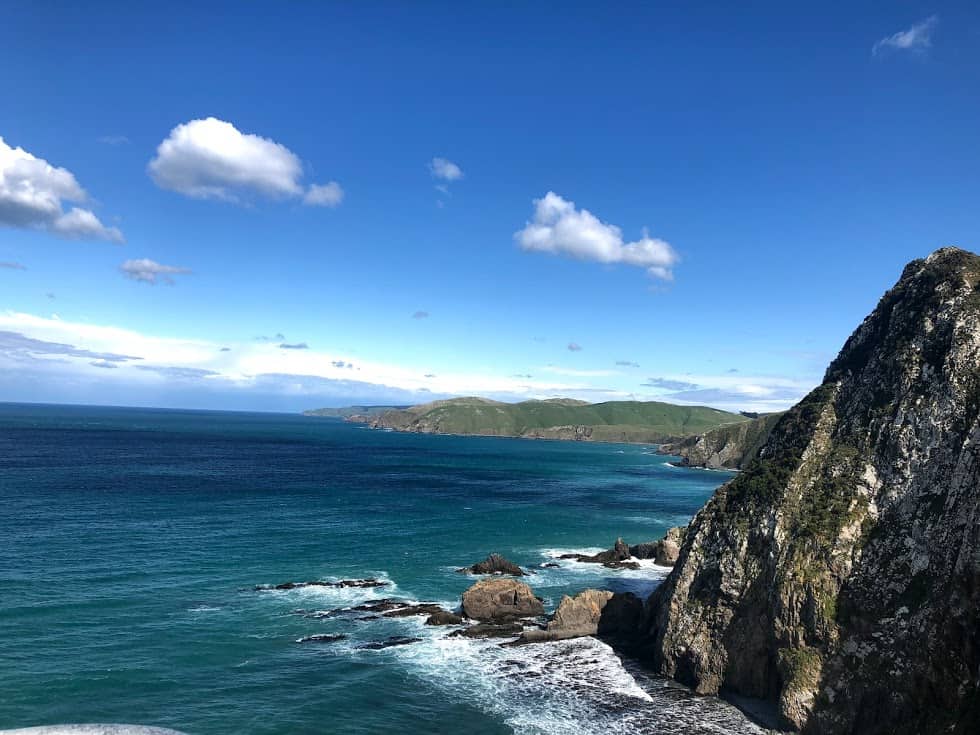
The Catlins sits on the southernmost tip of New Zealand’s South Island, strung along roughly 170 kilometres of coast between Balclutha and Invercargill. This Catlins three-day itinerary is how we’d still do it: a comfortable pace that lets you actually stop the car, rather than a mad dash to tick off waterfalls.
In this article we discuss:
- Where to stay in the Catlins
- Where to camp in the Catlins
- What the roads and facilities are like
- A full three-day Catlins itinerary, including Nugget Point, Cathedral Caves, Curio Bay and Slope Point
Where to Stay in the Catlins
You’ll feel like you’re out in the middle of nowhere, but small settlements are strung along the Catlins coast, and most have at least a handful of B&Bs, motels or holiday homes alongside the camping options. Working roughly from the Balclutha end towards Invercargill:
Kaka Point
A small seaside village with sea views, motel rooms and holiday homes. This is a sensible first-night base if you’re arriving from Dunedin in the afternoon.
Owaka
The largest settlement in the Catlins and the closest thing to a service town, with a motel, a lake-side eco stay and a small supermarket.
Papatowai and Chasland
Quieter still, with a scattering of farm cottages and self-contained stays.
Curio Bay
Right by the petrified forest and dolphin beach, with a lodge and a handful of self-contained cottages nearby.
Prices shift constantly and a lot of these small operators only take direct bookings, so we’d rather send you to check current rates than quote you numbers from years ago. Booking.com and Airbnb both cover the Catlins reasonably well if you want to compare, and our guide to travelling New Zealand on a budget has more on stretching your accommodation budget generally.
Where to Camp in the Catlins
If you’re camping, you’re in luck: there are more places to pitch a tent or park a van here than there are places to stay indoors. You’ve got a choice of private campgrounds or DOC sites, some of which are free or close to it. Purakaunui Bay and Papatowai are two of the DOC campgrounds along the route, and both give you a proper, if basic, base for the night.
Some of the private sites have a few extra comforts. If you fancy a shared kitchen and a hot shower after a few nights on the road, look for one of the campgrounds that offer both, since not every site does.
If freedom camping in a certified self-contained vehicle is more your thing, the Catlins works well for it, though rules are tightening in various parts of New Zealand and vary district by district, so it’s worth reading up before you go. We’ve written more on how it actually works in our guide to freedom camping in NZ.
What the Roads Are Like
The main Southern Scenic Route through the Catlins is sealed, but there isn’t an intricate network of paved roads here, because this is still a rugged, lightly travelled part of the country. Plenty of the side roads that lead to the waterfalls, Cathedral Caves and some of the bays are unsealed gravel, and a decent stretch of the coastal loop road between Waikawa and Fortrose is gravel too.
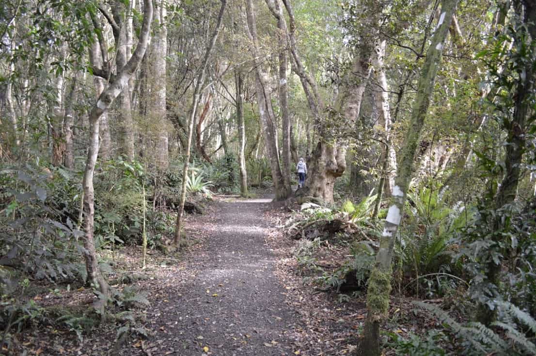
We drove it in a 10-metre motorhome and were genuinely worried beforehand about whether it would fit, but the roads turned out to be entirely manageable at a sensible pace. We even cycled some of the flatter stretches. Expect wild weather at short notice, heavy wind and rain aren’t unusual, and the unsealed sections get greasy in the wet, so ease off on the inclines if it’s been raining.
Fuel, Food and Signal: The Honest Version
Fuel up before you commit to the drive. If you’re heading north to south, fill up at Balclutha; south to north, do it in Invercargill. Owaka and Papatowai both have pumps, but they’re not always cheap and don’t keep long hours, so treat them as a backup rather than a plan.
There are cute cafes and a few restaurants dotted through the villages, but this is not a bustling tourist strip, and plenty close early evening. Either plan your dinner stop in advance or stock up on groceries before you arrive; we stocked up in Balclutha, since it was genuinely the only proper supermarket option on our route.
Don’t rely on your phone. There are real stretches of the Catlins with no signal at all, and wifi where it exists is patchy. Download maps and directions before you set off.
Your Three-Day Catlins Itinerary
We drove this route north to south, but it works just as well flipped around.
Day One: Kaka Point to Purakaunui Bay
From Balclutha, fuel up, grab groceries, and head for Kaka Point, about 20 minutes away via Kaka Point Road. It’s a lovely spot for a first stop, with fishing, water sports and a proper sea view.
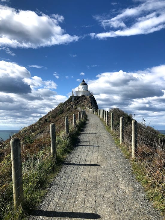
A little further along is Nugget Point, home to one of New Zealand’s oldest working lighthouses (first lit on 4 July 1870, so it’s genuinely historic, if not quite the country’s very oldest, that title belongs to Pencarrow Head near Wellington). The short walk out to the lighthouse is an easy, well-formed gravel path, about 1.8 kilometres return, and it’s popular for good reason. Below the lighthouse, the rocks are home to a breeding colony of NZ fur seals, plus NZ sea lions and, occasionally, Southern elephant seals, one of very few places in the country where you might see all three. You’ll also spot gannets and royal spoonbills, and possibly Hector’s dolphins offshore.
Walk towards Roaring Bay and there’s a real chance of seeing yellow-eyed penguins, known in Maori as hoiho. We need to be honest about this one: hoiho are now one of the rarest penguins on earth, and DOC and Forest & Bird both reported the Catlins population falling sharply, down around 37% between 2021 and 2023, with their joint October 2025 nest count in the Catlins penguin reserve the lowest ever recorded. If you’re lucky enough to see one, give it space: stay well back (10 metres or more), use any viewing hide provided, don’t block the path between the sea and the nesting area, and watch from a distance around dawn or dusk when they’re heading out to or returning from the water, rather than approaching. These are stressed, struggling birds, and a good photo isn’t worth a failed breeding season.
If conditions are calm, it’s worth the inland detour to Jack’s Blowhole, which only really performs in rough seas, though the sheer scale of the crater is impressive regardless. Back on the coast, head into the forest to Purakaunui Falls, a gentle 20-minute return walk (wheelchair accessible as far as the top viewing platform) to a genuinely beautiful three-tiered waterfall. Spend the night at the DOC campground at Purakaunui Bay.
Day Two: Papatowai to Curio Bay
Head down to Papatowai for the Picnic Point walk and a beach wander, or push on to the Tautuku boardwalk through the estuary. There are several short nature trails around here worth an hour or two.
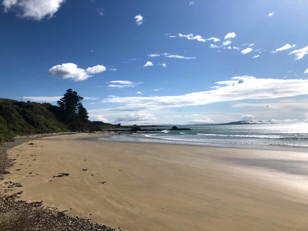
One of the genuine highlights is Cathedral Caves, roughly halfway between Papatowai and Waikawa. These are sea-formed caves you can actually walk into, and standing inside while the sea roars around you is something else. A few things to know before you go: the caves sit on Maori freehold land and access is only open from around late October to April (closed roughly May to October), and even in season the gate only opens for a window either side of low tide, so check the website the day before and again on the morning of your visit, since times shift with conditions. Entry was $15 per adult and $2 per child (5 to 14, under 5s free) at the time of writing, card only, so bring a card rather than cash. Budget a good 30 minutes each way on the walk in, and note it’s not wheelchair accessible.
If you’ve never seen a petrified forest, Curio Bay is your chance. At low tide, you can walk out and see the roughly 170-million-year-old fossilised remains of a forest still visible in the rock, complete with the outlines of tree trunks and stumps. The viewing platform works at any tide if you can’t time it exactly.
Porpoise Bay, right next door, has decent accommodation options including free camping and a hostel, and makes a good base for night two.
Day Three: Porpoise Bay to Fortrose
Start with a walk on Porpoise Bay beach, and if it’s warm enough, get in the water: this bay is also home to the Hector’s dolphins we mentioned on Day One, one of the smallest and rarest dolphin species in the world. If you’re swimming or kayaking and dolphins turn up, don’t chase them; enter the water at least 50 metres away and let them approach if they’re curious, never touch or feed them.
If you’re up for a proper walk, the Waipohatu Walking Track feels like a pocket of rainforest, with thick bush and waterfalls tumbling through it. After that, head for the southernmost tip of the South Island.
Slope Point genuinely feels like standing at the edge of the world, and you’re closer to Antarctica than most people ever get. Access is via an informal farm track across private grazing land, so keep to the marked route, and close any gate behind you. There’s no public access during lambing season, roughly September to November, so check before you plan around it.
From there it’s on to Waipapa Point, home to a lighthouse with a genuinely tragic wreck story attached (worth reading the sign on site), and another good spot for sea lions. Fortrose rounds things off with boating, fishing and a golf course, plus a shipwreck visible at low tide. There’s a campsite and a cottage option if you want to finish the trip here.
There’s plenty more to see if you slow the pace down further and give an area an extra day. The Catlins isn’t a box-ticking exercise, and it rewards taking it slowly. If you’re building this into a longer trip, our 10-day South Island self-drive itinerary shows where the Catlins fits alongside the rest of the island, and the Moeraki Boulders make a good stop on your way down from Dunedin.
We were genuinely worried our 10-metre motorhome wouldn’t cope with these roads, and were relieved to find it managed fine. It was well worth the detour on our way to Queenstown. If you’re after scenery that nature built rather than tourism polished, the Catlins is worth every gravel-road minute.
Your questions answered
Is the Catlins worth the detour if we’re short on time? It’s a genuine detour off the main Dunedin to Invercargill or Queenstown route, adding at least half a day each way if you don’t stop, more if you do. We’d still say yes, even a rushed one-night version beats skipping it, but three days lets you actually enjoy it rather than photograph it through a windscreen.
Do you need a 4WD to drive the Catlins? No. A standard car, campervan or motorhome handles the sealed and gravel sections fine at a sensible speed. Just slow right down on the gravel, especially after rain, and take care on the narrower coastal stretches.
What’s the best time of year to see yellow-eyed penguins in the Catlins? Breeding season runs roughly September to February, when adults are commuting between nest and sea and you’ve the best chance of a sighting from a hide at dawn or dusk. Numbers are low and falling, so treat any sighting as a privilege, not a given, and never approach.
Can you still visit Cathedral Caves if the tide doesn’t cooperate? Not really, the gate is only open around low tide, and the caves are closed outside that window regardless of season. Build flexibility into your itinerary rather than a fixed time slot, and check the Cathedral Caves website the day before for that day’s opening times.
Is there mobile signal in the Catlins? Patchy at best, and non-existent in real stretches, particularly around the coastal loop roads. Download offline maps and let someone know your rough plan before you head in.
Can you swim near the Hector’s dolphins at Curio Bay? You can be in the water at Porpoise Bay when dolphins are around, but the etiquette matters: enter at least 50 metres away, never chase or touch them, and let them choose whether to approach. They’re one of the world’s smallest and rarest dolphins, found only in New Zealand waters.
Where’s the best overnight stop if we only have two nights, not three? Purakaunui Bay after day one and Curio Bay or Porpoise Bay after day two work well if you’re compressing the trip, since they bookend the two biggest wildlife draws (Nugget Point and Curio Bay) without a mad final dash to Fortrose.
Got a Catlins question we haven’t covered here? Get in touch through our [contact page](/con
You might also like

Aoraki / Mount Cook Travel Guide
Our real Aoraki / Mount Cook guide: Hooker Valley Track status, Tasman Glacier, Dark Sky stargazing and where to stay. Updated August 2026.
A Weekend on the Coromandel Peninsula
Our updated 2026 guide to a weekend on the Coromandel Peninsula: Cathedral Cove's current access, Hot Water Beach timing, road status and where to stay.
The New Zealand bucket list: experiences that are actually worth it
Our honest New Zealand bucket list: 11 experiences from ten years living there, with genuine opinions on what's worth it and what to skip. Updated 2026.